North Carolina's Unique Wetlands
What are Unique Wetlands in North Carolina?
In North Carolina, all surface waters are assigned a primary classification by the NC Division of Water Resources (DWR). Supplemental classifications are sometimes added by DWR to provide additional protection to waters with special uses or values, including wetlands. The Unique Wetland (UWL) supplemental classification is a special designation for wetlands of exceptional state or national ecological significance which require special protection to maintain existing uses. UWLs may include wetlands that have been documented as habitat essential for the conservation of state or federally listed threatened or endangered species.
The added UWL protections include:
- Impacts to UWLs will only be permitted for projects that meet a demonstrated public need.
- Any fill of UWLs requires written approval from the NC DWR
- Mitigation for the loss of existing use will be required regardless of the area of the impact requested.
Where are the North Carolina Unique Wetlands?
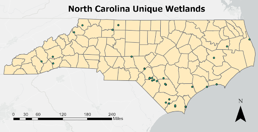
The UWL classification started with an EPA-funded project to identify North Carolina UWLs and develop technical and policy guidelines. On November 1, 2007, 33 wetlands were reclassified to UWLs under 15 NCAC 02B .0101. On September 1, 2020, through the efforts of the University of North Carolina at Asheville, Mountain True, Defenders of Wildlife, the Southern Environmental Law Center, and several private property owners, the 10-acre
Sandy Bottom Natural Area Wetland, in Buncombe County, North Carolina, was reclassified to UWL.
How are Unique Wetlands Identified?
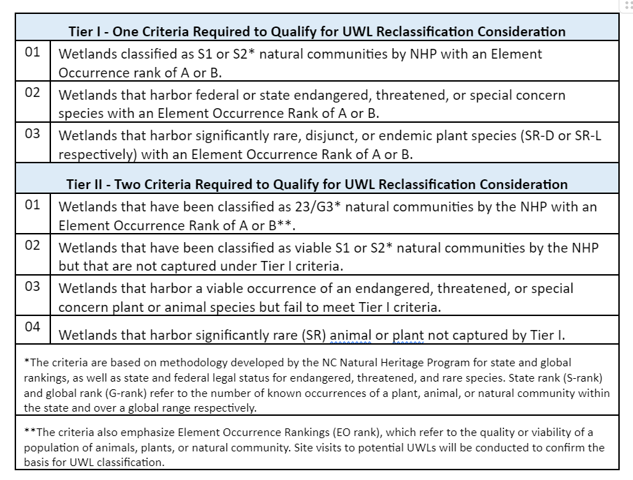
A two-tiered classification system is in place to identify Unique Wetlands. Sites that meet any Tier I criteria can be considered for reclassification. Sites that fail to meet Tier I criteria must meet two or more Tier II criteria to be considered for reclassification.
Note: Only jurisdictional wetlands are eligible for this classification.
What is the process to reclassify a wetland to Unique Wetland?
The reclassification of a waterbody in North Carolina is generally a two-year process that is administered by the DWR’s Classification and Standards Program. The following steps outline the process for wetland to be reclassified as a Unique Wetland.
- Submit Application to Request Reclassification of NC Surface Water to Classifications and Standards Branch
- DWR presents the proposal for wetland reclassification to UWL to the Water Quality Committee of the Environmental Management Commission for approval.
- If approved the state will do a Regulatory Impact Analysis (Fiscal Analysis).
- DWR presents the Request for Reclassification and the Regulatory Impact Analysis to the full EMC for approval.
- A public hearing is held in the community where the UWL is located. It is very important to have local stakeholder support for reclassification.
- A public notice is issued for a 60-day comment period (this step can overlap with step 5).
- DWR prepares a Hearing Office Report for the EMC. The EMC decides to deny or adopt the reclassification.
- If adopted the reclassified UWL goes to the Rules Review Commission which puts out a notice for comment for 24 hours.
- Then to Legislature for Rule Writing
- Final EPA approval or denial.
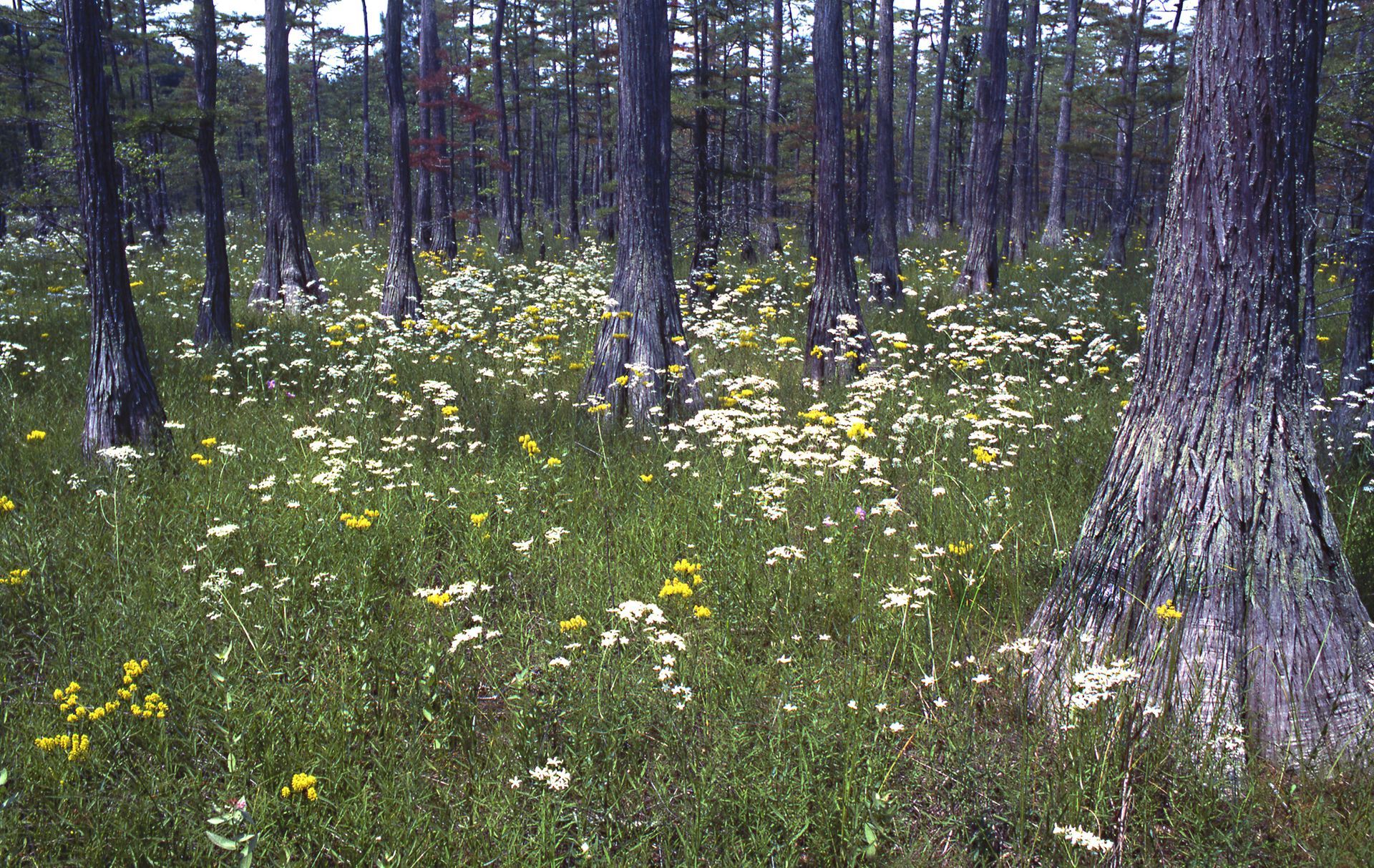
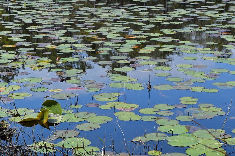
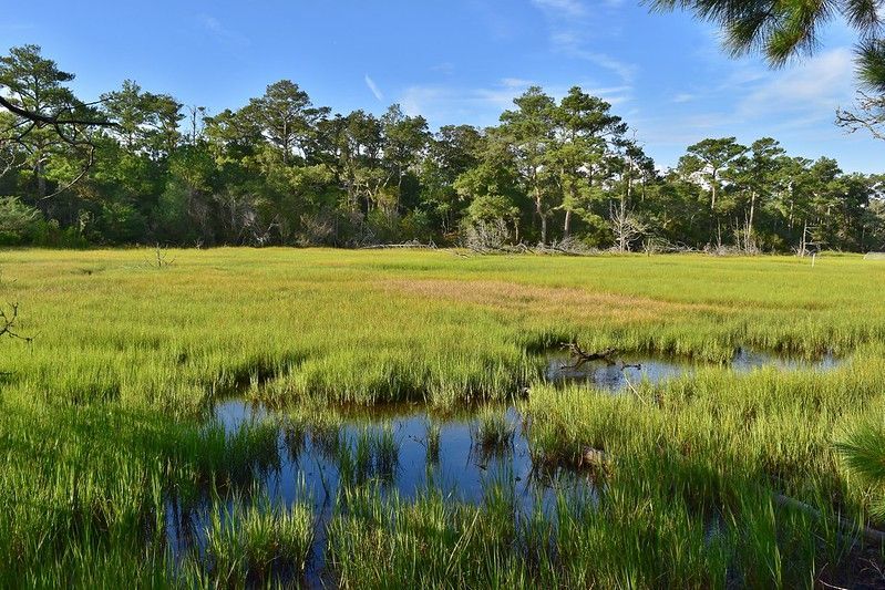
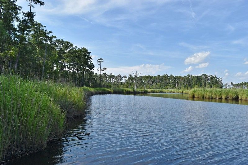
Gallery of Unique Wetlands
What is a wetland?
A wetland is any place where there is shallow water or very soggy soil. The soil could be either permanently or seasonally saturated or inudated (flooded) with water. Because of the presence of water, the wetland will develop “hydric” or wet soils and provide habitat for plants that thrive in a wetter environment. Wetlands are the link between dry land and bodies of water, making them unique ecosystems that support many important processes that do not occur elsewhere.
Why should we care about wetlands?
Wetlands are often described as the “kidneys of the landscape” because of the important natural benefits they provide:
- Wetlands act like a giant sponge, holding water for a variety of services across the landscape.
- Wetland protect our communities from flooding.
- Wetlands protect lake and estuarine shorelines from erosion.
- Wetlands provide critical habitat for endangered species, and a wide variety of other wildlife.
- Wetlands clean and filter water for drinking, swimming, boating, and fishing.
- Wetlands help regulate stream flow and recharge our groundwater.
- Wetlands provide food for fish and shellfish (like oysters) that we eat.
- Wetlands provide places for outdoor education, recreation, and relaxation.
Without wetlands, many animals and plants would become extinct, and flooding and pollution would be much worse.
Lakes are wet, are they wetlands too?
No – they are too wet. Remember wetland plants? Lakes are mostly too deep for wetland plants to take hold. But, wetlands can develop along the edges of lakes.
Where do wetlands develop?
Wetlands can form anywhere that water may sit long enough for a saturated soil to develop. Wetlands are typically found by rivers, streams, lakes, and the ocean, but they can also develop in upland depressions or at the base of a hillslope.
How do wetlands get wet?
Rain and snow melt feed water to wetlands. Wetlands also receive water from beneath the ground, from surface runoff, and floodwaters from rivers, streams, or ocean tides.
What are the types of wetlands and how are they define?
Wetland scientists have developed “classification systems” to organize wetlands with similar characteristics. Two of the most common systems are known as “Cowardin” and “Hydrogeomorphic” (HGM) classification systems and can be used anywhere in the United Stations. The “North Carolina Wetland Assessment Method” (NCWAM) was developed specifically for North Carolina and is useable in South Carolina and Virginia.
What wetland characteristics are used by the NCWAM classification system?
Hydrology – Does the water source seep from underground, or does it flow overland from rivers, streams, or ocean tides? Is the wetland flooded for most of the year or is the soil saturated for a few months?
Landscape position – Is the wetland near a lake, river, or stream or is it higher up in the watershed and surrounded by upland?
Soil type – Does the wetland have mineral soil like sand or silt, or is the soil organic like the muck or peat found in a bog?
Vegetation structure – Is the wetland forested, shrub covered, or herbaceous?
Dominant vegetation species – What types of trees, shrubs, or herbaceous plants are most prevalent in the wetland community?
Click here to learn more about types of wetland communities in the Carolinas
What are our wetlands worth?
Report from the Dogwood Alliance Quantifies the Values that Wetland Forests Provide the Communities of the Southern US. Click here to read the report.
- NC Fact Sheet – Click here
- SC Fact Sheet – Click here
References
Brinson. M.M. 1993. A hydrogeomorphic classification for wetlands, Technical Report WRP-DE-4, U.S. Army Corps of Engineers Engineer Waterways Experiment Station, Vicksburg, MS.
Cowardin, L. M., V. Carter, F. C. Golet, and E. T. LaRoe. 1979. Classification of Wetlands and Deep Water Habitats of the United States.
Wisconsin Wetlands Association website: wisconsinwetlands.org, 214 N. Hamilton St. #201 Madison, WI 53703.
Mitsch, W.J. and J.G. Gosselink. Wetlands, 2nd Edition. Van Nostrand Reinhold Publishing. 1995. National Wildlife Federation. 2016.
Nelson, John B. The Natural Communities of South Carolina. 1986. South Carolina Wildlife & Marine Resources Department.
North Carolina Wetland Functional Assessment Team. 2010. North Carolina Wetland Assessment Method (NCWAM) Version 4.1.
Schafale, Michael P. Guide to the Natural Communities of N. C., Fourth Approximation. 2012. North Carolina Natural Heritage Program, NC Department of Environment and Natural Resources.
US Environmental Protection Agency. 2016. National Wetland Condition Assessment 2011: A Collaborative Survey of the Nation’s Wetlands.
Mailing Address
Carolina Wetlands Association
PO Box 3359
Raleigh, NC 27636
Mailing Address
Carolina Wetlands Association
PO Box 3359
Raleigh, NC 27636
Mailing Address
Carolina Wetlands Association
PO Box 3359
2Raleigh, NC 27636
All Rights Reserved | Carolina Wetlands Association
